Map 13893: Tryne and Wyatt Earp Islands (Helicopter Operations)
Map details
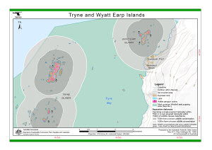
| Map Number | 13893 |
| Title | Tryne and Wyatt Earp Islands (Helicopter Operations) |
| Edition | 3 (Out of Date) |
| Previous edition | [Previous edition : 2] |
| Next Edition | [Next Edition : 4] |
| Scale | 1 : 40 000 |
| Publication date | May 2011 |
| Publisher | - |
| Spatial coverage |
( 78.3610° -68.3480°)
,
( 78.6100° -68.3480°)
,
( 78.6100° -68.4020°)
( 78.3610° -68.4020°) |
| Projection | Universal Transverse Mercator |
| Physical size | 21 x 29.7 cm A4 |
| Keywords | - |
Downloads
This is a digital map available for downloading.
Map Lists
No maps lists available.
Additional Information
| Horizontal datum | WGS84 |
| Vertical datum | Mean sea level |
| Vertical unit | Metres |
| Nomenclature | Australian Antarctic Gazetteer |
Preview