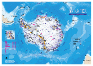
Map 13939: Antarctica and the Southern Ocean
Map details
| Map Number | 13939 |
| Title | Antarctica and the Southern Ocean |
| Edition | 9 (Out of Date) |
| Previous edition | [Previous edition : 8] |
| Next Edition | [Next Edition : 10] |
| Scale | 1 : 20 000 000 |
| Publication date | March 2011 |
| Publisher |
Australian Antarctic Division (Australia)
|
| Spatial coverage |
(-180.0000° -35.0000°)
,
(180.0000° -35.0000°)
,
(180.0000° -90.0000°)
(-180.0000° -90.0000°) |
| Projection | Polar Stereographic |
| Physical size | 42 x 59.5 cm |
| Notes | The reverse side of the map includes information about Antarctica, a map showing territorial claim boundaries and the CCAMLR Statistical Reporting Area and a distance matrix. |
| Keywords | CCAMLR , Claim , Distance , Topographic |
Downloads
This is a digital map available for downloading.
- National Library of Australia Bib ID 5299917 (External site)
- A LZW compressed TIFF
- A LZW compressed TIFF (back)
- A print file (PDF)
- A print file (PDF) (back)
Map Lists
No maps lists available.
Additional Information
| Nomenclature | Names from the SCAR Composite Gazetteer |
Preview