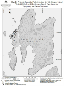
Map 13948: Antarctic Specially Protected Area No 167
Hawker Island, Vestfold Hills, Ingrid Christensen Coast, East Antarctica
Map B: Topography and Fauna Distribution
Map details
| Map Number | 13948 |
| Title | Antarctic Specially Protected Area No 167 Hawker Island, Vestfold Hills, Ingrid Christensen Coast, East Antarctica Map B: Topography and Fauna Distribution |
| Edition | 1 (Out of Date) |
| Next Edition | [Next Edition : 2] |
| Scale | 1 : 15 000 |
| Publication date | April 2011 |
| Publisher |
Australian Antarctic Division (Australia)
|
| Spatial coverage |
( 77.8200° -68.6300°)
,
( 77.8800° -68.6300°)
,
( 77.8800° -68.6500°)
( 77.8200° -68.6500°) |
| Projection | Universal Transverse Mercator |
| Physical size | 19.8 x 14.7 cm |
| Notes | This map was produced for the 2011 management plan for ASPA 167. |
| Keywords | ASPA |
Downloads
This is a digital map available for downloading.
Map Lists
No maps lists available.
Additional Information
| Horizontal datum | WGS84 |
| Vertical datum | Mean Sea Level |
| Nomenclature | Australian Antarctic Gazetteer |
Preview