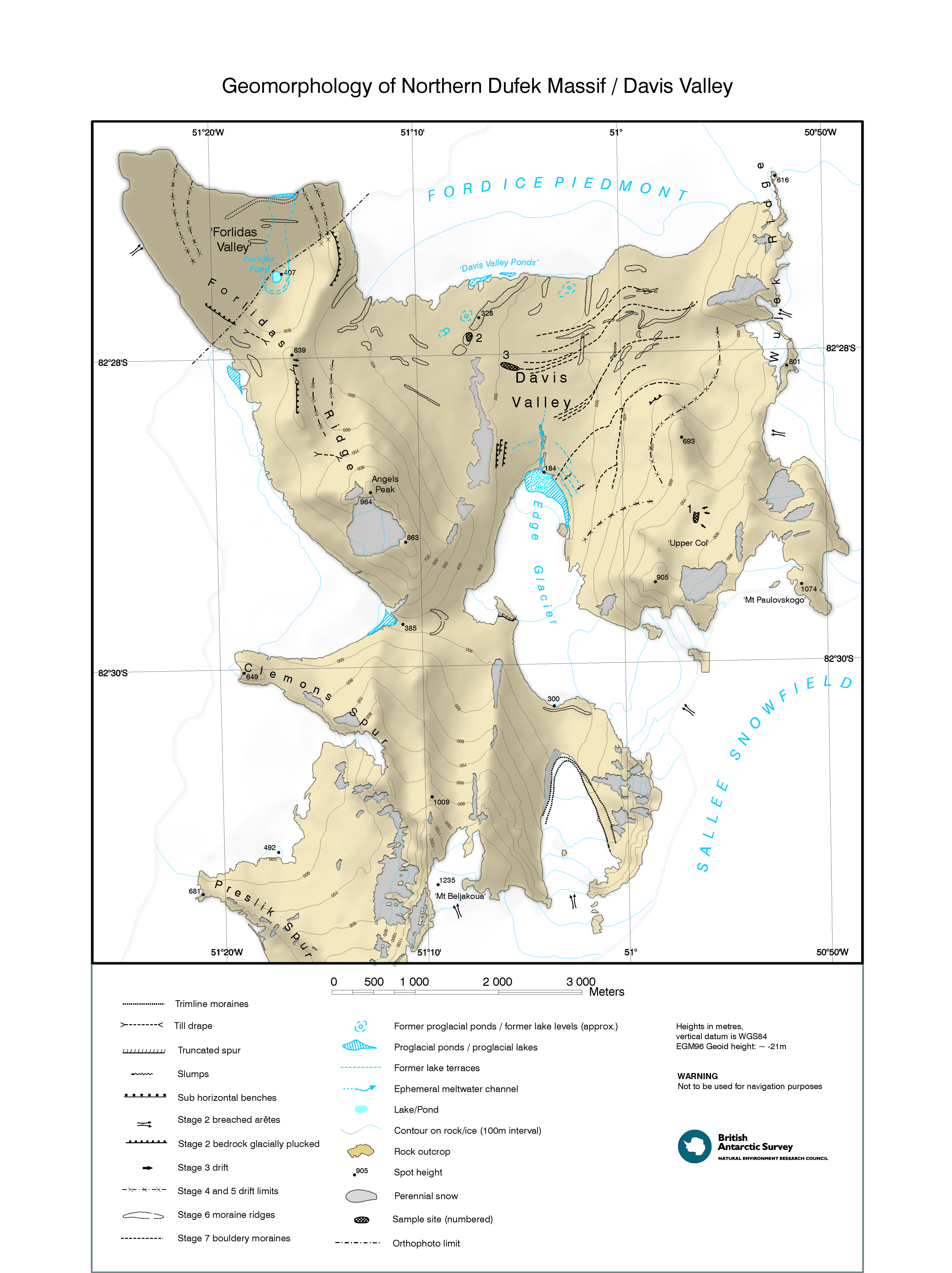
Map 14010: Geomorphology of Northern Dufek Massif / Davis Valley
Map details
| Map Number | 14010 |
| Title | Geomorphology of Northern Dufek Massif / Davis Valley |
| Edition | 1 |
| Scale | 1 : 35 000 |
| Publication date | 2010 |
| Publisher |
British Antarctic Survey (United Kingdom)
|
| Spatial coverage |
( -51.4667° -82.4250°)
,
( -50.6667° -82.4250°)
,
( -50.6667° -82.5667°)
( -51.4667° -82.5667°) |
| Projection | Polar Stereographic |
| Physical size | 69 x 52 cm |
| Notes | Projection: Polar stereographic. Latitude of true scale 82° 30' south, central meridian 51° west. |
| Keywords | Davis Valley , Dufek Massif , Forlidas Ridge , Forlidas Valley , Edge Glacier , Clemons Spur , Proslik Spur , Sallee Snowfield , Wujek Ridge , Ford Ice Piedmont , Angels Peak , David Valley Ponds , Survey Marks , Geology |
Downloads
Map Lists
No maps lists available.
Additional Information
| Horizontal datum | WGS84 |
Preview
