Map 14033: Kerguelen Plateau to Antarctica
Map details
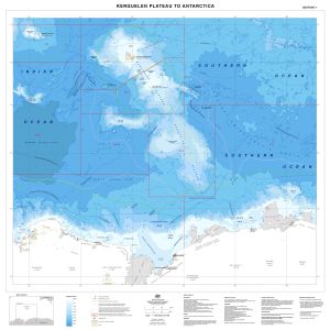
| Map Number | 14033 |
| Title | Kerguelen Plateau to Antarctica |
| Edition | 1 |
| Scale | 1 : 4 000 000 |
| Publication date | February 2013 |
| Publisher |
Australian Antarctic Division (Australia)
|
| Spatial coverage |
( 47.0574° -44.2172°)
,
(105.8354° -44.2172°)
,
(105.8354° -70.4988°)
( 47.0574° -70.4988°) |
| Projection | Mercator |
| Physical size | 98 x 96 cm |
| Keywords | Kerguelen , Crozet , Heard , Eez , Exclusive Economic Zone , CCAMLR , Bathymetry , Southern Ocean , Bathymetry |
Downloads
This is a digital map available for downloading.
Map Lists
This map belongs to the following lists. Use the link on the list to see all maps belonging to that list
Additional Information
| Horizontal datum | WGS84 |
Preview