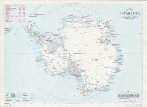
Map 14065: Antarctica
Map details
| Map Number | 14065 |
| Title | Antarctica |
| Edition | 3 (Out of Date) |
| Previous edition | [Previous edition : 2] |
| Next Edition | [Next Edition : 4] |
| Scale | 1 : 20 000 000 |
| Publication date | 1979 |
| Publisher |
Department of National Development, Division of National Mapping (Australia)
|
| Spatial coverage |
(-180.0000° -50.0000°)
,
(180.0000° -50.0000°)
,
(180.0000° -90.0000°)
(-180.0000° -90.0000°) |
| Projection | Polar Stereographic |
| Physical size | 35.2 x 48 cm |
| Notes |
Antarctic Peninsula stations listed, Without claims |
| Reference | NMP/79/009 |
| Keywords | Antarctica And The Southern Ocean , Topographic |
Downloads
- National Library of Australia Bib ID 1628958 (External site)
- A LZW compressed TIFF
- A print file (PDF)
Map Lists
No maps lists available.
Additional Information
Preview