Map 14142: Geology of Northern Jetty Peninsula
Map details
| Map Number | 14142 |
| Title | Geology of Northern Jetty Peninsula |
| Edition | 1 |
| Scale | 1 : 25 000 |
| Publication date | December 2012 |
| Publisher |
Geoscience Australia (Australia)
|
| Spatial coverage |
( 68.6417° -70.3000°)
,
( 69.0167° -70.3000°)
,
( 69.0167° -70.5000°)
( 68.6417° -70.5000°) |
| Projection | Universal Transverse Mercator |
| Physical size | 88 x 83 cm |
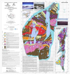
| Notes |
This map displays the geology of Else Platform and Kamenistaja Platform. In April 2013 the map was awarded first place in the Organisational Static Display Map category at the Australian Surveying and Spatial Sciences Conference 2013 map competition. |
| Reference | GeoCat 74654 |
| Keywords | Else , Platform , Kamenistaja , Melkoe , Chistoe , Geology |
Downloads
This is a digital map available for downloading.
Map Lists
This map belongs to the following lists. Use the link on the list to see all maps belonging to that list
Additional Information
| Horizontal datum | WGS84 |
| Vertical datum | Mean sea level |
| Nomenclature | SCAR Composite Gazetteer of Antarctica |
Preview