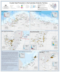
Map 14226: Crustal Heat Production in the Australian Antarctic Territory
Map details
| Map Number | 14226 |
| Title | Crustal Heat Production in the Australian Antarctic Territory |
| Edition | 1 |
| Scale | 1 : 1 500 000 |
| Publication date | August 2016 |
| Publisher |
Geoscience Australia (Australia)
|
| Spatial coverage |
( 44.0000° -65.5000°)
,
(102.0000° -65.5000°)
,
(102.0000° -75.0000°)
( 44.0000° -75.0000°) |
| Projection | Lambert Conformal Conic |
| Physical size | 94 x 77.5 cm |
| Notes |
This poster consists of six maps: Map 1 - Enderby Land, scale 1:1 500 000 Map 2 - Mawson Coast and Kemp Land, scale 1: 1 500 000 Map 3 - Northern Prince Charles Mountains, scale 1: 1 500 000 Map 4 - Southern Prince Charles Mountains and Grove Mountains, scale 1: 1 500 000 Map 5 - Vestfold Hills and Southern Prydz Bay, scale 1: 1 000 000 Map 6 - Bunger Hills and Denman Glacier Region, scale 1: 750 000 |
| Keywords | Enderby , Mawson , Kemp , Prince Charles , Grove , Vestfold , Prydz , Bunger , Denman , Geology |
Downloads
This is a digital map available for downloading.
Map Lists
This map belongs to the following lists. Use the link on the list to see all maps belonging to that list
Additional Information
| Horizontal datum | WGS84 |
| Vertical datum | Mean sea level |
| Nomenclature | Australian Antarctic Gazetteer |
Preview