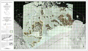
Map 14241: Larsemann Hills, Princess Elizabeth Land, Satellite Image Map
Map details
| Map Number | 14241 |
| Title | Larsemann Hills, Princess Elizabeth Land, Satellite Image Map |
| Edition | 3 |
| Previous edition | [Previous edition : 2] |
| Scale | 1 : 25 000 |
| Publication date | July 2015 |
| Publisher |
Australian Antarctic Division (Australia)
|
| Spatial coverage |
( 75.8800° -69.3400°)
,
( 76.5100° -69.3400°)
,
( 76.5100° -69.4800°)
( 75.8800° -69.4800°) |
| Projection | Universal Transverse Mercator |
| Physical size | 75.1 x 126 cm |
| Notes | The map includes the ASMA, ASPA and facilities zone as shown in the Management Plan for the Larsemann Hills, East Antarctica. |
| Alternative title | Larsemann Hills, Princess Elizabeth Land |
| Keywords | Larsemann Hills , Stornes Peninsula , Broknes Peninsula , Thala Fjord , Quilty Bay , Dalkoy Bay , Dalk Glacier , Johnston Fjord , Barry Jones Bay , Webster Bay , Clemence Fjord , Nella Fjord , Satellite Imagery |
Downloads
This is a digital map available for downloading.
Map Lists
This map belongs to the following lists. Use the link on the list to see all maps belonging to that list
Additional Information
| Horizontal datum | WGS84 |
| Vertical datum | Mean sea level |
| Magnetic variation | Magnetic north is 80 deg. west of grid north |
| Nomenclature | Australian Antarctic Names Gazetteer |
Preview