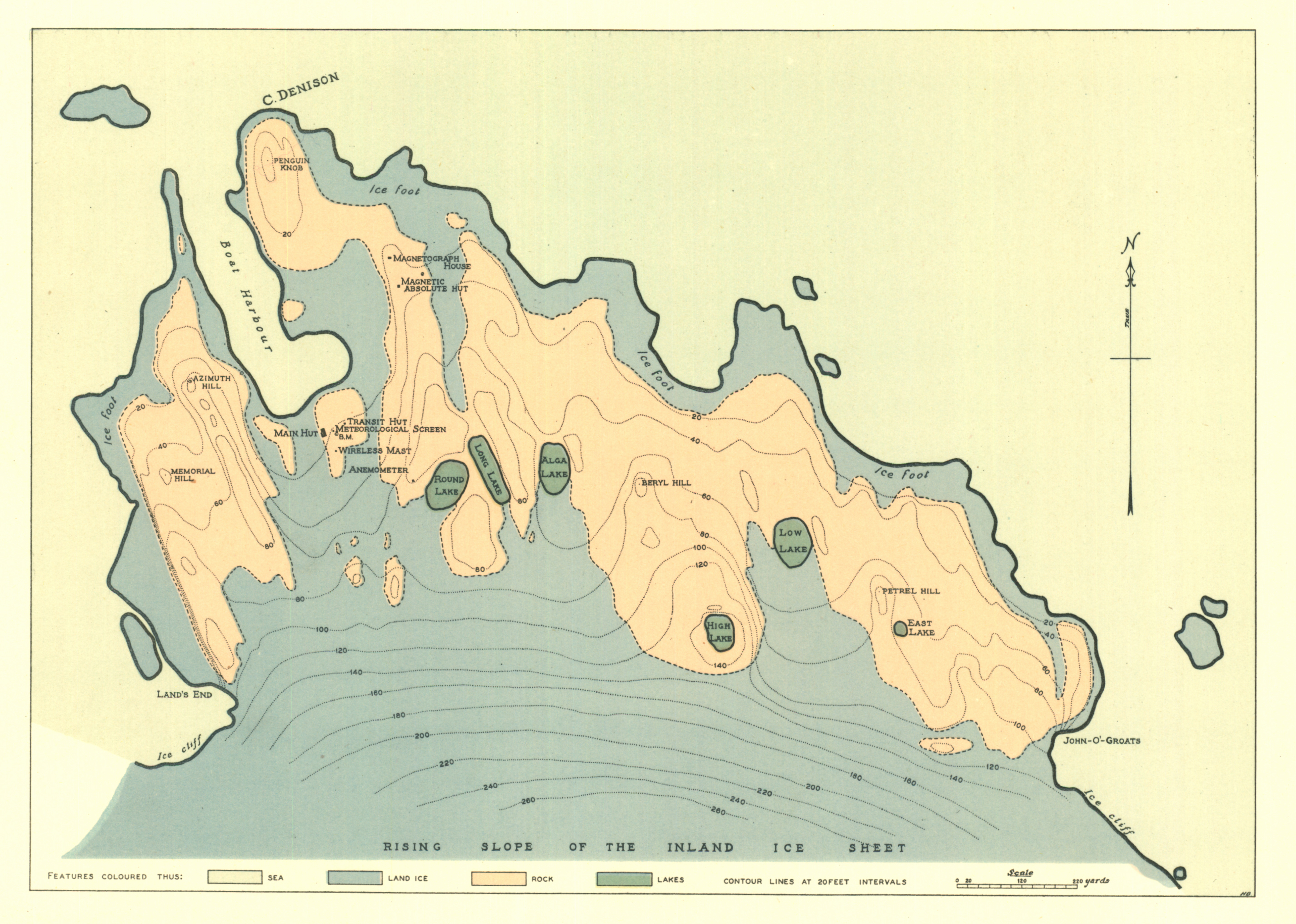
Map 14284: The Main Base locality, Cape Denison
Map details
| Map Number | 14284 |
| Title | The Main Base locality, Cape Denison |
| Edition | - |
| Scale | 1 : 4020 |
| Publication date | January 1942 |
| Publisher | - |
| Spatial coverage |
(142.6494° -67.0025°)
,
(142.6967° -67.0025°)
,
(142.6967° -67.0167°)
(142.6494° -67.0167°) |
| Projection | - |
| Physical size | 18.9 x 26.1 cm |
| Notes | The map is the frontispiece in 'Australasian Antarctic Expedition 1911-14 Scientific Reports Series A Volume 1' by Douglas Mawson published 1942. |
| Reference | Australasian Antarctic Expedition 1911-14 Scientific Reports Series A Volume 1 by Douglas Mawson published 1942. |
| Keywords | Australasian Antarctic Expedition , AAE , historical |
Downloads
Map Lists
This map belongs to the following lists. Use the link on the list to see all maps belonging to that list
Additional Information
Preview