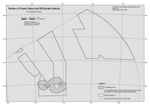
Map 14290: Territory of Heard Island and McDonald Islands
Prohibited Area
Map details
| Map Number | 14290 |
| Title | Territory of Heard Island and McDonald Islands Prohibited Area |
| Edition | 1 |
| Scale | 1 : 2 400 000 |
| Publication date | May 2014 |
| Publisher |
Australian Antarctic Division (Australia)
|
| Spatial coverage |
( 70.1169° -49.6458°)
,
( 79.5736° -49.6458°)
,
( 79.5736° -53.7514°)
( 70.1169° -53.7514°) |
| Projection | Gnomonic |
| Physical size | 21 x 29.7 cm A4 |
| Notes | This map identifies the area of the Heard Island and McDonald Islands Marine Reserve for which entry has been prohibited by the Director of National Parks in accordance with subregulation 12.23(3) of the Environment Protection and Biodiversity Conservation Regulations 2000, except where specified preconditions are met. |
| Keywords | - |
Downloads
This is a digital map available for downloading.
Map Lists
This map belongs to the following lists. Use the link on the list to see all maps belonging to that list
Additional Information
| Horizontal datum | WGS84 |
Preview