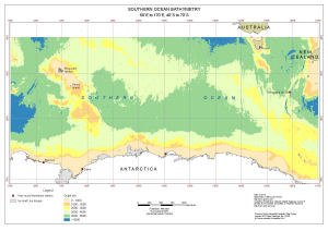
Map 14346: Southern Ocean Bathymetry
50°E to 170°E, 40°S to 70°S
Map details
| Map Number | 14346 |
| Title | Southern Ocean Bathymetry 50°E to 170°E, 40°S to 70°S |
| Edition | 1 |
| Scale | 1 : 17 000 000 |
| Publication date | January 2015 |
| Publisher |
Australian Antarctic Division (Australia)
|
| Spatial coverage |
( 49.5228° -35.4411°)
,
(170.4703° -35.4411°)
,
(170.4703° -70.6094°)
( 49.5228° -70.6094°) |
| Projection | Mercator |
| Physical size | 29.7 x 42 cm A3 |
| Keywords | Bathymetry |
Downloads
This is a digital map available for downloading.
Map Lists
This map belongs to the following lists. Use the link on the list to see all maps belonging to that list
Additional Information
| Horizontal datum | WGS84 |
Preview