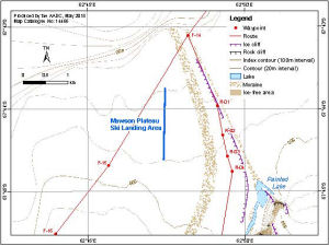
Map 14466: Mawson Plateau Ski Landing Area
Map details
| Map Number | 14466 |
| Title | Mawson Plateau Ski Landing Area |
| Edition | 1 |
| Scale | 1 : 50 000 |
| Publication date | May 2015 |
| Publisher |
Australian Antarctic Division (Australia)
|
| Spatial coverage |
( 62.7092° -67.7136°)
,
( 62.8719° -67.7136°)
,
( 62.8719° -67.7589°)
( 62.7092° -67.7589°) |
| Projection | Universal Transverse Mercator |
| Physical size | 11 x 14.7 cm |
| Notes | This map was produced for the AAD Intra-Continental Aviation Manual 2015. |
| Keywords | - |
Downloads
This is a digital map available for downloading.
Map Lists
This map belongs to the following lists. Use the link on the list to see all maps belonging to that list
Additional Information
| Horizontal datum | WGS84 |
| Vertical datum | Mean sea level |
| Nomenclature | Australian Antarctic Gazetteer |
Preview