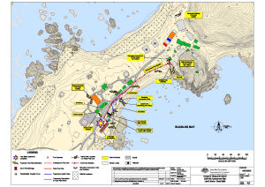
Map 14473: Annex B: Macquarie Island Spill Risk Assessment Map
Land and Marine-Based Spills
Map details
| Map Number | 14473 |
| Title | Annex B: Macquarie Island Spill Risk Assessment Map Land and Marine-Based Spills |
| Edition | 4 |
| Previous edition | [Previous edition : 3] |
| Scale | 1 : 1300 |
| Publication date | 02 July 2014 |
| Publisher |
Australian Antarctic Division (Australia)
|
| Spatial coverage |
(158.9317° -54.4975°)
,
(158.9422° -54.4975°)
,
(158.9422° -54.5011°)
(158.9317° -54.5011°) |
| Projection | Universal Transverse Mercator |
| Physical size | 42 x 59.4 cm A2 |
| Notes | Map published in the Australian Antarctic Division fuel spill contingency plans. |
| Reference | MQ/08/02 |
| Keywords | Spill Risk , Drum Farm , Fixed Fuel Pipeline , Valve Drain Location , Valve Pit , Oil |
Downloads
This is a digital map available for downloading.
Map Lists
This map belongs to the following lists. Use the link on the list to see all maps belonging to that list
Additional Information
Preview