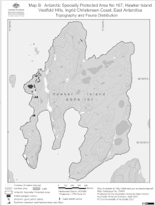
Map 15405: Antarctic Specially Protected Area No 167
Hawker Island, Vestfold Hills, Ingrid Christensen Coast, East Antarctica
Map B: Topography and Fauna Distribution
Map details
| Map Number | 15405 |
| Title | Antarctic Specially Protected Area No 167 Hawker Island, Vestfold Hills, Ingrid Christensen Coast, East Antarctica Map B: Topography and Fauna Distribution |
| Edition | 3 |
| Previous edition | [Previous edition : 2] |
| Scale | 1 : 15 000 |
| Publication date | April 2021 |
| Publisher |
Australian Antarctic Division (Australia)
|
| Spatial coverage |
( 77.8200° -68.6250°)
,
( 77.8800° -68.6250°)
,
( 77.8800° -68.6480°)
( 77.8200° -68.6480°) |
| Projection | Universal Transverse Mercator |
| Physical size | 19.8 x 14.7 cm |
| Notes | This map was produced for the 2016 management plan for ASPA 167. |
| Keywords | ASPA |
Downloads
This is a digital map available for downloading.
Map Lists
This map belongs to the following lists. Use the link on the list to see all maps belonging to that list
- Vestfold Hills / Davis - extended list
- Antarctic Specially Protected Areas and Antarctic Specially Managed Areas maps
Additional Information
| Horizontal datum | WGS84 |
| Vertical datum | Mean Sea Level |
| Nomenclature | Australian Antarctic Gazetteer |
Preview