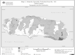
Map 15412: Antarctic Specially Protected Area No. 103
Odbert Island
Map C: Topography and Bird Distribution
Map details
| Map Number | 15412 |
| Title | Antarctic Specially Protected Area No. 103 Odbert Island Map C: Topography and Bird Distribution |
| Edition | 4 |
| Previous edition | [Previous edition : 3] |
| Scale | 1 : 15 000 |
| Publication date | April 2021 |
| Publisher |
Australian Antarctic Division (Australia)
|
| Spatial coverage |
(110.5111° -66.3653°)
,
(110.5778° -66.3653°)
,
(110.5778° -66.3806°)
(110.5111° -66.3806°) |
| Projection | Universal Transverse Mercator |
| Physical size | 15 x 20 cm |
| Notes | The map was produced for the 2015 management plan for ASPA 103. |
| Keywords | ASPA |
Downloads
This is a digital map available for downloading.
Map Lists
This map belongs to the following lists. Use the link on the list to see all maps belonging to that list
- Windmill Islands / Casey - extended list
- Antarctic Specially Protected Areas and Antarctic Specially Managed Areas maps
Additional Information
| Horizontal datum | WGS84 |
| Vertical datum | Mean sea level |
| Nomenclature | Australian Antarctic Gazetteer |
Preview