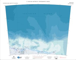
Map 15568: SQ 41-42
Map details
| Map Number | 15568 |
| Title | SQ 41-42 |
| Edition | 3 |
| Previous edition | [Previous edition : 2] |
| Scale | 1 : 1 000 000 |
| Publication date | December 2023 |
| Publisher |
Australian Antarctic Division (Australia)
|
| Spatial coverage |
( 60.0000° -64.0000°)
,
( 72.0000° -64.0000°)
,
( 72.0000° -68.0000°)
( 60.0000° -68.0000°) |
| Projection | Lambert Conformal Conic |
| Physical size | 54 x 68 cm |
| Reference | ISBN: 978-1-876934-53-8 |
| Alternative title | International Map of the World 1:1 000 000 |
| Keywords | Mawson , Southern Ocean , Mawson Corridor , Taylor Rookery , Rookery Islands , Holme Bay , Framnes Mountains , Mawson Coast , Mac Robertson Land , Mac. Robertson Land , Auster Rookery , Storegg Bank , Gustav Bull Mountains , Scullin Monolith , Murray Monolith , Cape Rouse , Lars Christensen Coast , Bjerko Peninsula , Flutter Rookery , Fram Bank , Sq41-42 , Topographic |
Downloads
This is a digital map available for downloading.
- A print file (Georeferenced PDF)
- Georeferenced TIF
- 1M topographic series 2023 legend and data sources
Map Lists
This map belongs to the following lists. Use the link on the list to see all maps belonging to that list
Additional Information
| Horizontal datum | WGS84 |
| Vertical datum | Mean Sea Level |
| Vertical unit | Metres |
| Nomenclature | Australian Antarctic Gazetteer |
Preview