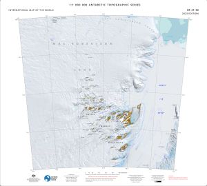
Map 15578: SR 41-42
Map details
| Map Number | 15578 |
| Title | SR 41-42 |
| Edition | 3 |
| Previous edition | [Previous edition : 2 DRAFT] |
| Scale | 1 : 1 000 000 |
| Publication date | December 2023 |
| Publisher |
Australian Antarctic Division (Australia)
|
| Spatial coverage |
( 60.0000° -68.0000°)
,
( 72.0000° -68.0000°)
,
( 72.0000° -72.0000°)
( 60.0000° -72.0000°) |
| Projection | Lambert Conformal Conic |
| Physical size | 55 x 61 cm |
| Reference | ISBN: 978-1-876934-62-0 |
| Alternative title | International Map of the World 1:1 000 000 |
| Keywords | Prince Charles Mountains , Sr41-42 , Amery Ice Shelf , Mawson Coast , Lars Christensen Coast , Mackenzie Bay , Foley Promontory , Landon Promontory , Single Island , Gillock Island , Jetty Peninsula , Fisher Massif , Mount Meredith , Beaver Lake , Aramis Range , S3 , Survey Marks , northern |
Downloads
This is a digital map available for downloading.
- Georeferenced TIF
- A print file (Georeferenced PDF)
- 1M topographic series 2023 legend and data sources
Map Lists
This map belongs to the following lists. Use the link on the list to see all maps belonging to that list
Additional Information
| Horizontal datum | WGS84 |
| Vertical datum | Mean sea level |
| Vertical unit | Metres |
| Nomenclature | Australian Antarctic Gazetteer |
Preview