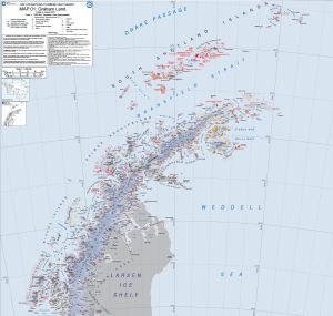
Map 15959: Map 01: Graham Land
Map details
| Map Number | 15959 |
| Title | Map 01: Graham Land |
| Edition | 4 |
| Scale | 1 : 1 000 000 |
| Publication date | August 2022 |
| Publisher |
British Antarctic Survey (United Kingdom)
|
| Spatial coverage |
( -70.8600° -60.9300°)
,
( -50.1500° -60.9300°)
,
( -50.1500° -68.2200°)
( -70.8600° -68.2200°) |
| Projection | Polar Stereographic |
| Physical size | 83.1 x 87.5 cm |
| Alternative title | Air Operations Planning Maps |
| Keywords | - |
Downloads
This is a digital map available for downloading.
- Link to multiple files required for georeferenced Tiff - download all files for Map 1
- A print file (PDF)
Map Lists
This map belongs to the following lists. Use the link on the list to see all maps belonging to that list
Additional Information
| Vertical unit | Feet |
Preview