Map 16030: Bunger Hills Satellite Image Map
Map details
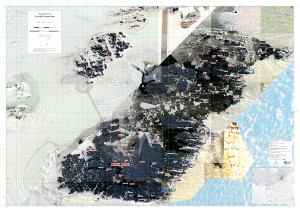
| Map Number | 16030 |
| Title | Bunger Hills Satellite Image Map |
| Edition | 1 |
| Scale | 1 : 50 000 |
| Publication date | November 2023 |
| Publisher |
Australian Antarctic Division (Australia)
|
| Spatial coverage |
(100.2489° -65.9798°)
,
(101.4850° -65.9798°)
,
(101.4850° -66.3496°)
(100.2489° -66.3496°) |
| Projection | Universal Transverse Mercator |
| Physical size | 84.1 x 118.9 cm A0 |
| Notes | Map produced for AAD Field Operations use. Print @ A0. Digital for use in Avenza. |
| Keywords | Satellite Imagery |
Downloads
This is a digital map available for downloading.
Map Lists
This map belongs to the following lists. Use the link on the list to see all maps belonging to that list
Additional Information
| Horizontal datum | WGS84 |
| Nomenclature | Australian Antarctic Gazetteer |
Preview