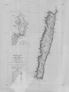
Map 1672: Macquarie Island
Map details
| Map Number | 1672 |
| Title | Macquarie Island |
| Edition | - |
| Scale | 1 : 50 000 |
| Publication date | April 1970 |
| Publisher |
Department of National Development, Division of National Mapping (Australia)
|
| Spatial coverage |
(158.6000° -54.4667°)
,
(159.0000° -54.4667°)
,
(159.0000° -54.8000°)
(158.6000° -54.8000°) |
| Projection | Universal Transverse Mercator |
| Physical size | - |
| Notes | Contour map |
| Reference | NMP/68/025 |
| Keywords | - |
Downloads
This is a hard copy map that has been scanned. See information about obtaining copies of hard copy maps.
Map Lists
No maps lists available.
Additional Information
| Vertical unit | Metres |
Preview