Map 3531: Cape Adare
Map details
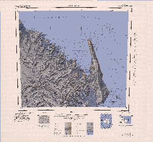
| Map Number | 3531 |
| Title | Cape Adare |
| Edition | 1 |
| Scale | 1 : 250 000 |
| Publication date | 1970 |
| Publisher |
US Geological Survey (United States of America)
|
| Spatial coverage |
(168.0000° -71.0000°)
,
(171.5000° -71.0000°)
,
(171.5000° -72.0000°)
(168.0000° -72.0000°) |
| Projection | Lambert Conformal Conic |
| Physical size | 66 x 68.5 cm |
| Notes | Mapped, edited and published by the U.S. Geological Survey in cooperation with the National Science Foundation Antarctica 1:250,000 reconnaissence series |
| Reference | SR 59-60/13* |
| Keywords | Cape Adare , Admiralty Mountains , Possession Island , Duke Of York Island , Foyn Island , Dubridge Range , Geikie Ridge , Survey Marks , Topographic |
Downloads
Map Lists
This map belongs to the following lists. Use the link on the list to see all maps belonging to that list
Additional Information
| Vertical datum | Mean Sea Level |
| Nomenclature | U.S Board on Geographic Names |
Preview