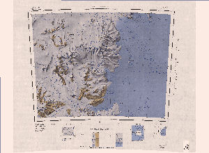
Map 3536: Carlyon Glacier
Map details
| Map Number | 3536 |
| Title | Carlyon Glacier |
| Edition | 1 |
| Scale | 1 : 250 000 |
| Publication date | 1966 |
| Publisher |
US Geological Survey (United States of America)
|
| Spatial coverage |
(156.0000° -79.0000°)
,
(163.0000° -79.0000°)
,
(163.0000° -80.0000°)
(156.0000° -80.0000°) |
| Projection | Lambert Conformal Conic |
| Physical size | 66 x 76 cm |
| Notes | ST 57-60/13* |
| Reference | ST 57-60/13* |
| Keywords | Carlyon Glacier , Cook Mountains , Darwin Glacier , Darwin Mountains , Finger Ridges , Conway Range , Topographic |
Downloads
Map Lists
This map belongs to the following lists. Use the link on the list to see all maps belonging to that list
Additional Information
| Vertical datum | Mean Sea Level |
| Nomenclature | U.S Board on Geographic Names |
Preview