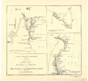
Map 3699: British Antarctic Expedition 1910-13 : Sketch map to illustrate the paper by Raymond E. Priestley on The Work of the Northern Party.
Map details
| Map Number | 3699 |
| Title | British Antarctic Expedition 1910-13 : Sketch map to illustrate the paper by Raymond E. Priestley on The Work of the Northern Party. |
| Edition | - |
| Scale | 1 : 5 000 000 |
| Publication date | 1914 |
| Publisher |
Royal Geographical Society (United Kingdom)
|
| Spatial coverage |
(155.0000° -70.0000°)
,
(180.0000° -70.0000°)
,
(180.0000° -78.0000°)
(155.0000° -78.0000°) |
| Projection | Not Given |
| Physical size | 35 x 37.5 cm |
| Notes | 2 insets of Terra Nova Bay (1:500,000) and Robertson Bay (1:500,000) |
| Reference | 1087 |
| Keywords | British Antarctic Expedition , Raymond E. Priestley , Drygalski Tongue , Terra Nova Bay , Robertson Bay , Reeves Glacier , Mt. Larsen , Mt. Melbourne , Mt Abbott , Cape Adare , Historical |
Downloads
Map Lists
This map belongs to the following lists. Use the link on the list to see all maps belonging to that list
Additional Information
Preview