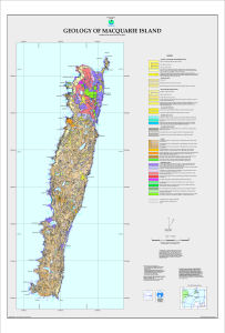
Map 5122: Geology of Macquarie Island
Map details
| Map Number | 5122 |
| Title | Geology of Macquarie Island |
| Edition | 1 |
| Scale | 1 : 50 000 |
| Publication date | 03 June 1998 |
| Publisher |
Australian Antarctic Division (Australia)
The Australian Antarctic Foundation (Australia) Mineral Resources Tasmania (Australia) |
| Spatial coverage |
(158.7512° -54.4672°)
,
(158.9769° -54.4672°)
,
(158.9769° -54.7904°)
(158.7512° -54.7904°) |
| Projection | Universal Transverse Mercator |
| Physical size | 85 x 60 cm |
| Notes | Contact Mineral Resources Tasmania if you wish to obtain a hard copy of the map. |
| Keywords | Geology |
Downloads
Map Lists
This map belongs to the following lists. Use the link on the list to see all maps belonging to that list
Additional Information
| Horizontal datum | WGS84 |
Preview