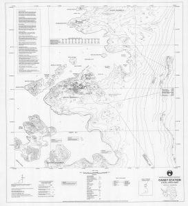
Map 5153: Casey Station Local Area Map
Map details
| Map Number | 5153 |
| Title | Casey Station Local Area Map |
| Edition | 3 |
| Previous edition | [Previous edition : 2] |
| Scale | 1 : 10 000 |
| Publication date | September 1996 |
| Publisher |
Australian Antarctic Division (Australia)
|
| Spatial coverage |
(110.4660° -66.2500°)
,
(110.6330° -66.2500°)
,
(110.6330° -66.3160°)
(110.4660° -66.3160°) |
| Projection | Universal Transverse Mercator |
| Physical size | 95 x 81 cm |
| Notes |
This map is out of date. See Windmill Islands / Casey map list for a current map of Casey. |
| Reference | (L44) |
| Keywords | Casey , Station , Local , Area , Map , Survey Marks , Topographic |
Downloads
This is a hard copy map that has been scanned. See information about obtaining copies of hard copy maps.
Map Lists
No maps lists available.
Additional Information
Preview