Map 5223: Adelie Land / Port Martin
Map details
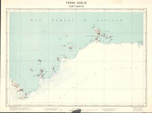
| Map Number | 5223 |
| Title | Adelie Land / Port Martin |
| Edition | - |
| Scale | 1 : 20 000 |
| Publication date | 1956 |
| Publisher |
Expeditions Polaires Francaises (France)
|
| Spatial coverage |
(141.3000° -66.7333°)
,
(141.7000° -66.7333°)
,
(141.7000° -66.8500°)
(141.3000° -66.8500°) |
| Projection | Polar Stereographic |
| Physical size | - |
| Notes | 4 colour map showing spot heights, contours at 5m intervals, ice-free rock; soundings, isobaths and penguin rookeries. Compiled from US Navy trimetrogon air photography 1947, with ground control by EPF 1950-52 |
| Alternative title | Terre Adelie / Port-Martin |
| Keywords | Terre Adelie , Port-Martin , Adelie Land , Topographic |
Downloads
No downloads available.
This is a hard copy map. See information about obtaining copies of hard copy maps.
Map Lists
No maps lists available.
Additional Information
Preview