Map 862: Bunger Hills, Taylor Islands - Flight Line Diagram
Map details
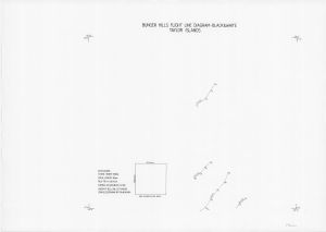
| Map Number | 862 |
| Title | Bunger Hills, Taylor Islands - Flight Line Diagram |
| Edition | - |
| Scale | 1 : 50 000 |
| Publication date | 26 January 1986 |
| Publisher |
Division of National Mapping (Australia)
|
| Spatial coverage |
(100.0000° -66.0000°)
,
(100.5000° -66.0000°)
,
(100.5000° -66.1667°)
(100.0000° -66.1667°) |
| Projection | Not Given |
| Physical size | 50.5 x 70.5 cm |
| Notes |
Flight lines 26 Jan 1986 Hasselblad EL 500 camera Film: TRI X 400 ASA |
| Keywords | Flight lines , aerial photography , Bunger |
Downloads
This is a hard copy map that has been scanned. See information about obtaining copies of hard copy maps.
Map Lists
No maps lists available.
Additional Information
Preview