Hippo Island
Hippo Island (The name as it would appear in a gazetteer)
Hippo Island (The name as it would appear on a map)
If this information is incorrect, please e-mail mapping@aad.gov.au
Place ID: 6405
Name ID: 851
Feature type:
Island
Origin
This name originates from Australia.
It is part of the
Australian Antarctic Gazetteer and the SCAR Composite Gazetteer of Antarctica.
Names that other countries have for this feature:
Narrative
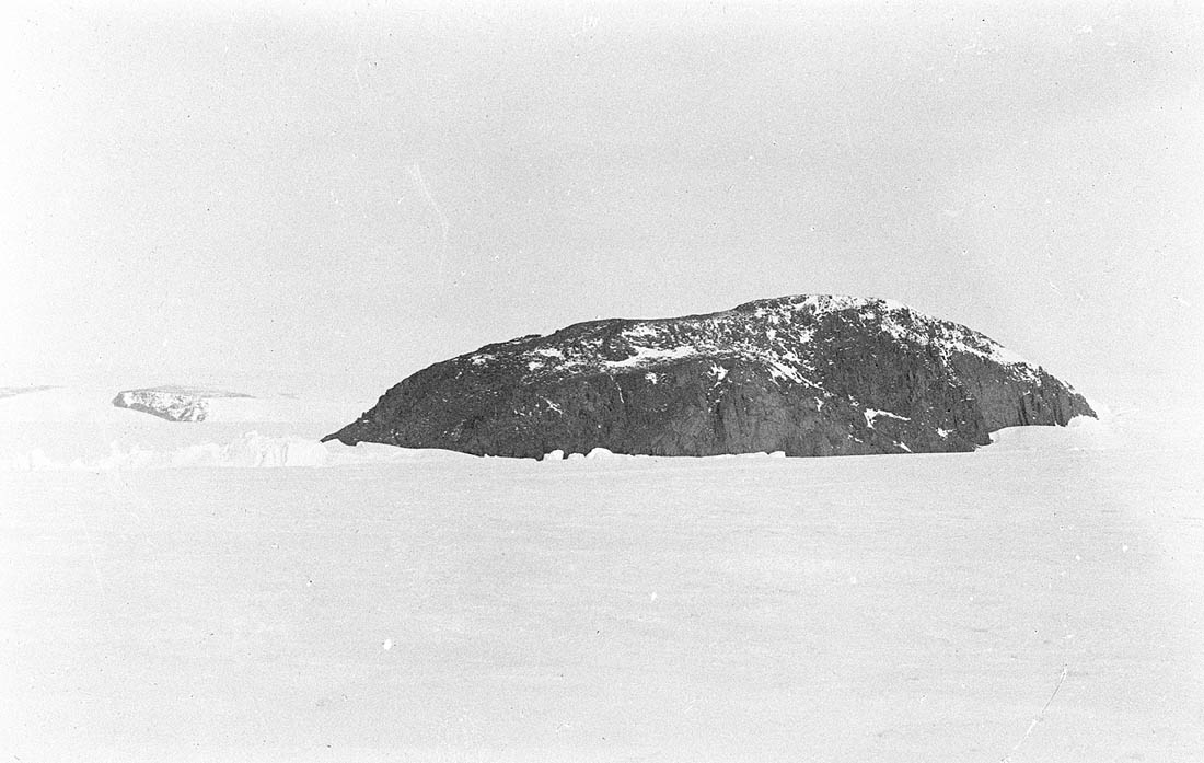
A small, steep, rocky island about 1 km long and about 75 m high, rising above the Shackleton Ice Shelf, about 3 km north of Delay Point, Queen Mary Land. Discovered and named by the Western Base Party of AAE (1911-14). So named because it is shaped like a hippopotamus.
Named For
Location
Latitude:
66° 25' 09.0" S
-66.41917°
Accurate to 200m
Longitude:
98° 10' 36.0" E
98.17667°
Accurate to 200m
Altitude:
Not recorded
Unknown precision
Images
©Dr. ANdrew Watson 1912
- Catalogue id
- IA16638
- Caption
- Hippo Island from the north. Delay Point, on the coast of the mainland, is seen in the distance on the left.
- Photographer
- Watson, Andrew
Map
Source
Location Method:
Satellite Image
Source Name:
LIMA - Landsat Image Mosaic Antarctica
Source Institution:
Australian Antarctic Division
Source Publisher:
USGS - United States Geological Survey
Remote sensing:
Not Applicable
Comments
None
Approval status
Related information