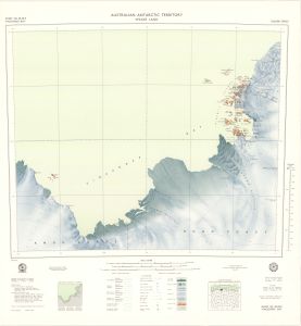
Map 108: Sheet SQ 49-50/9, Vincennes Bay, Australian Antarctic Territory, Wilkes Land
Map details
| Map Number | 108 |
| Title | Sheet SQ 49-50/9, Vincennes Bay, Australian Antarctic Territory, Wilkes Land |
| Edition | 1 |
| Scale | 1 : 250 000 |
| Publication date | March 1969 |
| Publisher |
Department of National Development, Division of National Mapping (Australia)
|
| Spatial coverage |
(108.0000° -66.0000°)
,
(111.0000° -66.0000°)
,
(111.0000° -67.0000°)
(108.0000° -67.0000°) |
| Projection | Universal Transverse Mercator |
| Physical size | 67 x 67 cm |
| Reference |
SQ49-50/9 Cat.No:M24 in 'ANARE Catalogue of Maps and Hydrographic Charts 1997' |
| Keywords | Vincennes Bay , Wilkes Land , Knox Coast , Budd Coast , Adams Glacier , Vanderford Glacier , Davis Islands , Windmill Islands , Penney Bay , Knowles Passage , Eyres Bay , Wilkes , Mitchell Peninsula , Bailey Peninsula , Frazier Islands , Donovan Islands , Swain Group , Holl Island , Sq49-50/9 , Survey Marks , Topographic |
Downloads
This is a hard copy map that has been scanned. See information about obtaining copies of hard copy maps.
- A LZW compressed TIFF
- A zipped image (TIF) of maps 108 and 85 for use in Oziexplorer
- A zipped image (TIF) for use in Oziexplorer
- A print file (PDF)
Map Lists
This map belongs to the following lists. Use the link on the list to see all maps belonging to that list
Additional Information
| Horizontal datum | International Spheroid |
| Nomenclature | Australian Antarctic Gazetteer |
Preview