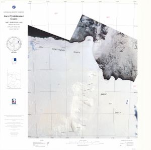
Map 109: Lars Christensen Coast, Mac.Robertson Land
Map details
| Map Number | 109 |
| Title | Lars Christensen Coast, Mac.Robertson Land |
| Edition | 1 |
| Previous edition | [Previous edition : 1] |
| Scale | 1 : 500 000 |
| Publication date | February 1993 |
| Publisher |
Australian Antarctic Division (Australia)
|
| Spatial coverage |
( 66.0000° -67.0000°)
,
( 72.5700° -67.0000°)
,
( 72.5700° -70.0035°)
( 66.0000° -70.0035°) |
| Projection | Lambert Conformal Conic |
| Physical size | 75 x 69 cm |
| Notes | Australian Antarctic Gazetteer |
| Reference |
SR 41-42b Cat.No:M7 in 'ANARE Catalogue of Maps and Hydrographic Charts 1997' |
| Keywords | Lars , Christensen , Coast , Mac. , Robertson , Mac , Land , Amery Ice Shelf , Tingey Rocks , Dodson Rocks , Single Island , Trost Rocks , Landon Promontory , Doggers Bay , Foley Promontory , Mechanics Bay , Twilight Bay , Mackenzie Bay , Bjerko Peninsula , Gustav Bull Mountains , Sr41-42B , Sr41-42/B , Satellite Imagery |
Downloads
This is a hard copy map that has been scanned. See information about obtaining copies of hard copy maps.
Map Lists
This map belongs to the following lists. Use the link on the list to see all maps belonging to that list
Additional Information
Preview