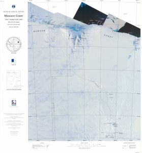
Map 110: Mawson Coast, Mac.Robertson Land
Map details
| Map Number | 110 |
| Title | Mawson Coast, Mac.Robertson Land |
| Edition | 1 |
| Previous edition | [Previous edition : Preliminary] |
| Scale | 1 : 500 000 |
| Publication date | February 1993 |
| Publisher |
Australian Antarctic Division (Australia)
|
| Spatial coverage |
( 60.0000° -67.0000°)
,
( 66.6400° -67.0000°)
,
( 66.6400° -70.0035°)
( 60.0000° -70.0035°) |
| Projection | Lambert Conformal Conic |
| Physical size | 75 x 69 cm |
| Reference |
SR 41-42a Cat.No:M6 in 'ANARE Catalogue of Maps and Hydrographic Charts 1997' |
| Keywords | Mawson , Coast , Mac. , Mac , Robertson , Land , Stinear Nunataks , Anare Nunataks , Framnes Mountains , David Range , Mason Range , Holme Bay , Casey Range , Robinson Group , Auster Rookery , Sr41-42A , Sr41-42/A , Satellite Imagery |
Downloads
This is a hard copy map that has been scanned. See information about obtaining copies of hard copy maps.
Map Lists
This map belongs to the following lists. Use the link on the list to see all maps belonging to that list
Additional Information
| Nomenclature | Australian Antarctic Gazetteer |
Preview