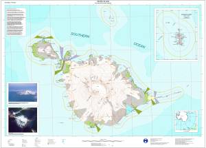
Map 12204: Heard Island including McDonald Islands
Map details
| Map Number | 12204 |
| Title | Heard Island including McDonald Islands |
| Edition | 2 |
| Previous edition | [Previous edition : 1] |
| Scale | 1 : 50 000 |
| Publication date | July 2000 |
| Publisher |
Australian Antarctic Division (Australia)
|
| Spatial coverage |
( 73.1200° -52.8700°)
,
( 73.9700° -52.8700°)
,
( 73.9700° -53.2300°)
( 73.1200° -53.2300°) |
| Projection | Universal Transverse Mercator |
| Physical size | 84 x 119 cm A0 |
| Notes | Insets: McDonald Islands (1:25,000); Location diagram |
| Keywords | Heard Island , Mcdonald Islands , Mawson Peak , Helicopter Flying Limits , Topographic |
Downloads
This is a digital map available for downloading.
Map Lists
This map belongs to the following lists. Use the link on the list to see all maps belonging to that list
Additional Information
| Horizontal datum | WGS84 |
| Vertical datum | msl |
| Nomenclature | Australian Antarctic Names Gazetteer |
Preview