Heard and McDonald Islands
View All Map ListsShowing 1 to 20 of 78 maps. On page 1 of 4, go to the Next Page
ANARE station heritage area, Atlas Cove View Map Details
Map ID - 14170
Published On - September-1995 Scale - 1 : c1000 Physical Size- - 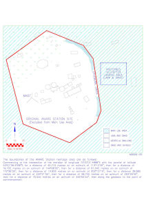
|
Atlas Cove former ANARE Station site View Map Details
Map ID - 14173
Published On - September-1995 Scale - 1 : 570 Physical Size- - 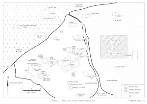
|
Atlas Cove Main Use Area View Map Details
Map ID - 14169
Published On - September-1995 Scale - 1 : c23 250 Physical Size- - 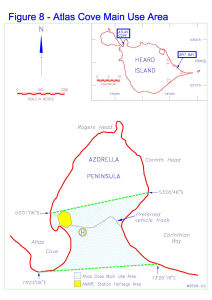
|
Aus 597 Australia - Southern Ocean - Approaches to Heard Island View Map Details
Map ID - 14602
Published On - 13-February-2015 Scale - 1 : 1 500 000 Physical Size- 73 x 110.5 cm Vertical Unit - Meters 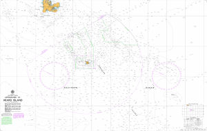
|
Aus 605 Australia - Southern Ocean - Heard and McDonald Islands View Map Details
Map ID - 14607
Published On - 18-July-2014 Scale - 1 : 150 000 Physical Size- 73 x 110.5 cm Vertical Unit - Meters 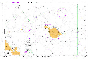
|
Australia's Maritime Jurisdiction around Heard Island and McDonald Islands View Map Details
Map ID - 14005
Published On - 2010 Scale - 1 : 3 000 000 Physical Size- 107.5 x 84 cm 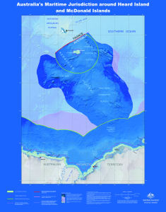
|
Australia's Maritime Jurisdiction around Heard Island and McDonald Islands View Map Details
Map ID - 14002
Published On - 2010 Scale - 1 : 3 000 000 Physical Size- 107.5 x 84 cm 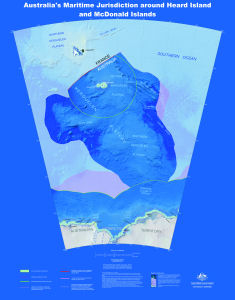
|
Azorella Peninsula, Heard Island View Map Details
Map ID - 13101
Published On - August-2004 Scale - 1 : 24 200 Physical Size- 17.1 x 11.4 cm 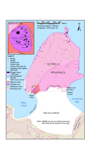
|
Current Heard Island and McDonald Islands Marine Reserve View Map Details
Map ID - 16153
Published On - 1-February-2024 Scale - Not Entered Physical Size- 14.8 x 21 cm Vertical Unit - Meters 
|
Glacial retreat on Heard Island View Map Details
Map ID - 13691
Published On - August-2009 Scale - 1 : 134 857 Physical Size- 29.7 x 42 cm A3 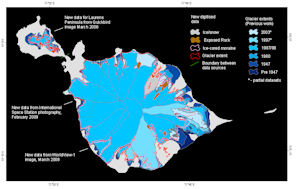
|
Heard Island View Map Details
Map ID - 11253
Published On - July-1999 Scale - 1 : 170 000 Physical Size- 21 x 29.7 cm A4 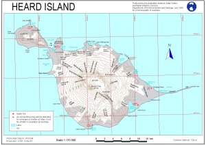
|
Heard Island View Map Details
Map ID - 12126
Published On - January-2000 Scale - Not Entered Physical Size- 21 x 29.7 cm A4 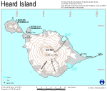
|
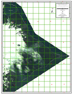
Heard Island - East : satellite image map View Map Details
Map ID - 13029
Published On - October-2003 Scale - 1 : 20 000 Physical Size- 83 x 62 cm 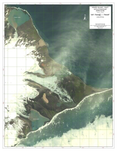
|
Heard Island - East : satellite image map
|
Heard Island - Science Map 1 of 5 View Map Details
Map ID - 13013
Published On - July-2003 Scale - 1 : 50 000 Physical Size- 29.7 x 42 cm A3 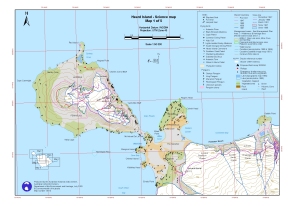
|
Heard Island - Science Map 2 of 5 View Map Details
Map ID - 13014
Published On - July-2003 Scale - 1 : 50 000 Physical Size- 29.7 x 42 cm A3 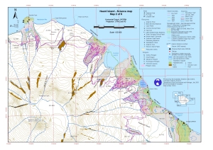
|
Heard Island - Science Map 3 of 5 View Map Details
Map ID - 13015
Published On - July-2003 Scale - 1 : 50 000 Physical Size- 29.7 x 42 cm A3 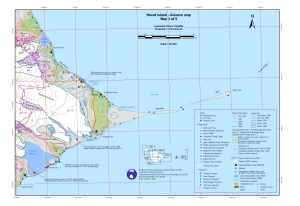
|
Heard Island - Science Map 4 of 5 View Map Details
Map ID - 13016
Published On - July-2003 Scale - 1 : 50 000 Physical Size- 29.7 x 42 cm A3 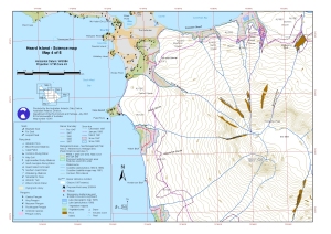
|
Heard Island - Science Map 5 of 5 View Map Details
Map ID - 13017
Published On - July-2003 Scale - 1 : 50 000 Physical Size- 29.7 x 42 cm A3 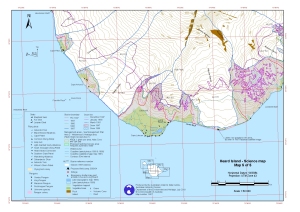
|
Heard Island & McDonald Islands (satellite image map) View Map Details
Map ID - 31
Published On - December-1991 Scale - 1 : 50 000 Physical Size- 69 x 99.3 cm 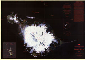
|
Showing 1 to 20 of 78 maps. On page 1 of 4, go to the Next Page