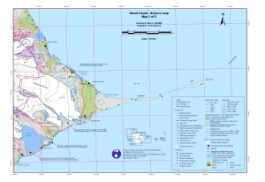
Map 13015: Heard Island - Science Map 3 of 5
Map details
| Map Number | 13015 |
| Title | Heard Island - Science Map 3 of 5 |
| Edition | 1 |
| Scale | 1 : 50 000 |
| Publication date | July 2003 |
| Publisher |
Australian Antarctic Division (Australia)
|
| Spatial coverage |
( 73.0333° -52.6000°)
,
( 74.0333° -52.6000°)
,
( 74.0333° -53.6000°)
( 73.0333° -53.6000°) |
| Projection | Universal Transverse Mercator |
| Physical size | 29.7 x 42 cm A3 |
| Notes | This map is available with lines of latitude and longitude or with a Universal Transverse Mercator grid (refer to the links below) |
| Keywords | Management Areas , Field Camps |
Downloads
This is a digital map available for downloading.
Map Lists
This map belongs to the following lists. Use the link on the list to see all maps belonging to that list
Additional Information
| Horizontal datum | WGS84 |
| Vertical datum | Mean Sea Level |
| Nomenclature | Australian Antarctic Names Gazetteer |
Preview