Heard and McDonald Islands
View All Map ListsShowing 21 to 40 of 78 maps. On page 2 of 4, go to the Previous Page or Next Page
Heard Island (1:1 million bathymetric map and soundings map) View Map Details
Map ID - 122
Published On - February-1995 Scale - 1 : 1 000 000 Physical Size- 59 x 73 cm 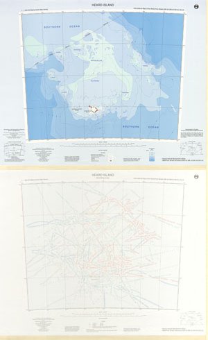
|
Heard Island [Black and white] View Map Details
Map ID - 13643
Published On - October-2004 Scale - 1 : 120 000 Physical Size- - ![Heard Island [Black and white]](/database/mapcat/heard/Heard_a3_b&w_13643_thumb.jpg)
|
Heard Island [Black and white] View Map Details
Map ID - 13138
Published On - May-2005 Scale - 1 : 853 600 Physical Size- 4 x 5.5 cm ![Heard Island [Black and white]](/database/mapcat/heard/heard_island_bw_thumb.jpg)
|
Heard Island and Macquarie Island in relation to Australia and Antarctica [Black and white] View Map Details
Map ID - 13994
Published On - September-2011 Scale - 1 : 122 830 256 Physical Size- 3.7 x 4.7 cm ![Heard Island and Macquarie Island in relation to Australia and Antarctica [Black and white]](/database/mapcat/heard/heard_location_ps_bw_13994_thumb.jpg)
|
Heard Island and McDonald Islands View Map Details
Map ID - 13099
Published On - August-2004 Scale - 1 : 210 000 Physical Size- - Vertical Unit - Meters 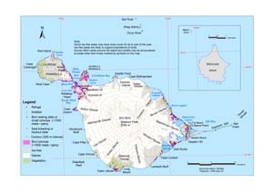
|
Heard Island and McDonald Islands View Map Details
Map ID - 14168
Published On - September-1995 Scale - 1 : c333 000 Physical Size- 15 x 17 cm A4 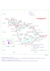
|
Heard Island and McDonald Islands / Scientific Research View Map Details
Map ID - 12817
Published On - June-2002 Scale - 1 : 50 000 Physical Size- 83 x 115 cm A0 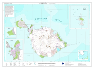
|
Heard Island and McDonald Islands EEZ, Territorial Sea, Continental Shelf, CCAMLR Statistical Areas and Antarctic Treaty Area View Map Details
Map ID - 16166
Published On - June-2024 Scale - 1 : 13 000 000 Physical Size- 21 x 29.7 cm A4 Vertical Unit - Meters 
|
Heard Island and McDonald Islands in relation to Australia and Antarctica View Map Details
Map ID - 13576
Published On - December-2008 Scale - 1 : 37 000 000 Physical Size- 14.8 x 21 cm 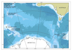
|
Heard Island and McDonald Islands Management Zones View Map Details
Map ID - 13100
Published On - August-2004 Scale - 1 : 194 320 Physical Size- 21 x 29.7 cm A4 Vertical Unit - Meters 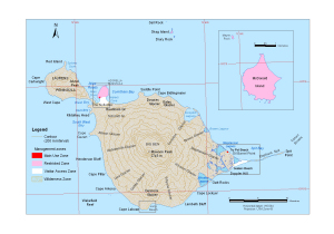
|
Heard Island and McDonald Islands Marine Reserve View Map Details
Map ID - 14357
Published On - March-2015 Scale - 1 : 3 800 000 Physical Size- 12.3 x 17.2 cm 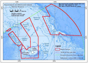
|
Heard Island and McDonald Islands Marine Reserve and Exclusive Economic Zone View Map Details
Map ID - 16014
Published On - September-2023 Scale - 1 : 4 500 000 Physical Size- 21 x 29.7 cm A4 Vertical Unit - Meters 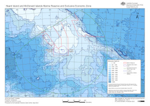
|
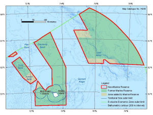
Heard Island and McDonald Islands Marine Reserve
|
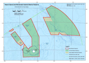
Heard Island and McDonald Islands Marine Reserve
|
Heard Island and McDonald Islands Satellite Image Map View Map Details
Map ID - 16187
Published On - June-2024 Scale - 1 : 50 000 Physical Size- 75 x 106 cm Vertical Unit - Meters 
|
Heard Island in relation to Australia and Antarctica [Black and white] View Map Details
Map ID - 13134
Published On - March-2005 Scale - 1 : 132 100 000 Physical Size- 3.7 x 4.7 cm ![Heard Island in relation to Australia and Antarctica [Black and white]](https://data.aad.gov.au/database/mapcat/heard/heard_australia_antarctica_thumb.jpg)
|
Heard Island including McDonald Islands View Map Details
Map ID - 12204
Published On - July-2000 Scale - 1 : 50 000 Physical Size- 84 x 119 cm A0 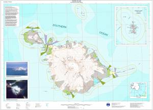
|
Heard Island including McDonald Islands View Map Details
Map ID - 29
Published On - December-1985 Scale - 1 : 50 000 Physical Size- 86.5 x 95 cm 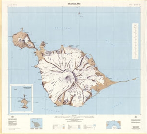
|
Heard Island Map 1 of 5 View Map Details
Map ID - 12680
Published On - December-2000 Scale - 1 : 50 000 Physical Size- 29.7 x 42 cm A3 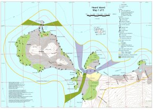
|
Heard Island Map 2 of 5 View Map Details
Map ID - 12681
Published On - December-2000 Scale - 1 : 50 000 Physical Size- 29.7 x 42 cm A3 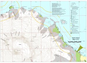
|
Showing 21 to 40 of 78 maps. On page 2 of 4, go to the Previous Page or Next Page