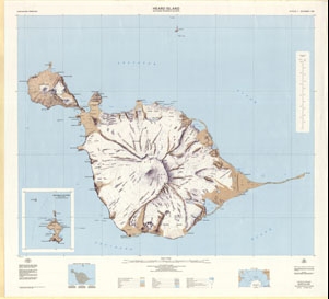
Map 29: Heard Island including McDonald Islands
Map details
| Map Number | 29 |
| Title | Heard Island including McDonald Islands |
| Edition | 3 |
| Previous edition | [Previous edition : 2] |
| Scale | 1 : 50 000 |
| Publication date | December 1985 |
| Publisher |
Department of National Development, Division of National Mapping (Australia)
|
| Spatial coverage |
( 73.2333° -52.9000°)
,
( 73.8833° -52.9000°)
,
( 73.8833° -53.2167°)
( 73.2333° -53.2167°) |
| Projection | Universal Transverse Mercator |
| Physical size | 86.5 x 95 cm |
| Notes | Single sided. |
| Reference | Cat.No:L2 in 'ANARE Catalogue of Maps and Hydrographic Charts 1997' |
| Keywords | Laurens , Red , Azorella , Elephant , Spit , Atlas , Cove , Nullarbor , Abbotsmith , Lied , Gotley , Gazert , Pillar , Arkona , Labuan , Fiftyone , Lockyer , Winston , Doppler , Stephenson , Skua , Scarlet , Dovers , Round , Brown , Compton , Ealey , Bidlingmaier , Saddle , Downes , Baudissin , Big Ben , Survey Marks , Topographic |
Downloads
This is a hard copy map that has been scanned. See information about obtaining copies of hard copy maps.
Map Lists
This map belongs to the following lists. Use the link on the list to see all maps belonging to that list
Additional Information
| Horizontal datum | WGS72 |
| Vertical datum | MSL |
| Nomenclature | Australian Antarctic Gazetteer |
Preview