Map 14168: Heard Island and McDonald Islands
Map details
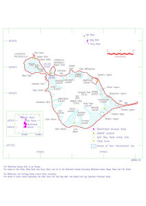
| Map Number | 14168 |
| Title | Heard Island and McDonald Islands |
| Edition | 1 |
| Scale | 1 : c333 000 |
| Publication date | September 1995 |
| Publisher |
Australian Antarctic Division (Australia)
|
| Spatial coverage |
( 73.1167° -52.8750°)
,
( 73.8667° -52.8750°)
,
( 73.8667° -53.2917°)
( 73.1167° -53.2917°) |
| Projection | Not Given |
| Physical size | 15 x 17 cm A4 |
| Notes | Published in the Heard Island Wilderness Reserve management plan, Sept 1995 (Figure 3). Held in Australian Antarctic Division Library at 502.45(*785.1) |
| Keywords | Laurens Peninsula , Azorella Peninsula , Sail Rock , Shag Rock , Red Island , Meyer Rock , Flat Rock |
Downloads
Map Lists
This map belongs to the following lists. Use the link on the list to see all maps belonging to that list
Additional Information
| Nomenclature | Australian Antarctic Gazetteer |
Preview