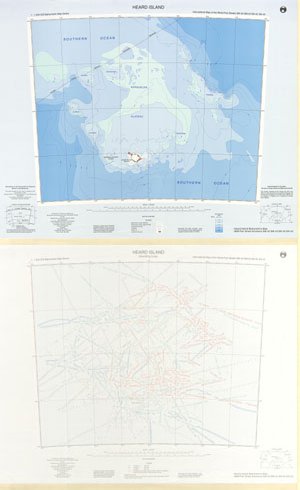
Map 122: Heard Island (1:1 million bathymetric map and soundings map)
Map details
| Map Number | 122 |
| Title | Heard Island (1:1 million bathymetric map and soundings map) |
| Edition | 1 |
| Scale | 1 : 1 000 000 |
| Publication date | February 1995 |
| Publisher |
Australian Antarctic Division (Australia)
|
| Spatial coverage |
( 70.0000° -50.0000°)
,
( 78.0000° -50.0000°)
,
( 78.0000° -54.0000°)
( 70.0000° -54.0000°) |
| Projection | Lambert Conformal Conic |
| Physical size | 59 x 73 cm |
| Notes | The map was published as a double sided map. One side is 1:1,000,000 bathymetric map series map, international map of the world part sheets SM-42, SM-43, SN-42, SN-43. The other side shows soundings from which the bathymetric contours were interpolated. |
| Reference |
sm-42 sm-43 sn-42 sn-42 sn-43 Cat.No:S32 in 'ANARE Catalogue of Maps and Hydrographic Charts 1997' |
| Keywords | Kerguelen Plateau , Southern Ocean , Shell Bank , Australia France Maritime Delimitation Agreement , Pike Bank , Discovery , Coral , Aurora , Mcdonald , Gunnari Ridge , Sm-42 Sm-43 Sn-42 Sn-43 , Sm-42 , Sm-43 , Sn-42 , Sn-43 , Bathymetry |
Downloads
This is a hard copy map that has been scanned. See information about obtaining copies of hard copy maps.
- Sounding lines (LZW compressed TIFF)
- Bathymetric map (PDF)
- Sounding lines (PDF)
- National Library of Australia Bib ID 2846998 (External site)
- Bathymetric map (LZW compressed TIFF)
Map Lists
This map belongs to the following lists. Use the link on the list to see all maps belonging to that list
Additional Information
Preview