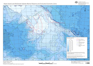
Map 16014: Heard Island and McDonald Islands Marine Reserve and Exclusive Economic Zone
Map details
| Map Number | 16014 |
| Title | Heard Island and McDonald Islands Marine Reserve and Exclusive Economic Zone |
| Edition | 3 |
| Previous edition | [Previous edition : 2] |
| Scale | 1 : 4 500 000 |
| Publication date | September 2023 |
| Publisher |
Australian Antarctic Division (Australia)
|
| Spatial coverage |
( 70.1169° -49.6458°)
,
( 79.5736° -49.6458°)
,
( 79.5736° -53.7514°)
( 70.1169° -53.7514°) |
| Projection | Gnomonic |
| Physical size | 21 x 29.7 cm A4 |
| Notes | The map shows the Heard Island and McDonald Islands Marine Reserve boundary that came into effect in March 2014. |
| Keywords | EEZ , Marine Reserve , Territorial Sea outer limit , Bathymetry |
Downloads
This is a digital map available for downloading.
Map Lists
This map belongs to the following lists. Use the link on the list to see all maps belonging to that list
Additional Information
| Horizontal datum | WGS84 |
| Vertical unit | Metres |
Preview