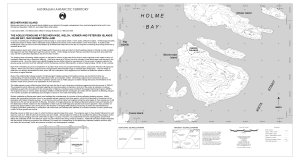
Map 12727: Bechervaise Island [Penguin Colonies : Topographical map]
Map details
| Map Number | 12727 |
| Title | Bechervaise Island [Penguin Colonies : Topographical map] |
| Edition | 1 |
| Scale | 1 : 6500 |
| Publication date | July 2000 |
| Publisher |
Australian Antarctic Division (Australia)
|
| Spatial coverage |
( 62.7889° -67.5750°)
,
( 62.8444° -67.5750°)
,
( 62.8444° -67.5972°)
( 62.7889° -67.5972°) |
| Projection | Universal Transverse Mercator |
| Physical size | 42 x 72 cm |
| Notes | See also Mapcat ref. 12724 "Bechervaise Island penguin colonies : Orthophoto map" (1:5000) Inset: Holme Bay "The Adelie penguins at Bechervaise, Welch, Verner and Petersen Islands, Holme Bay, Mac.Robertson Land" |
| Keywords | Bechervaise Island , Stinear Island , Kista Strait , Topographic |
Downloads
This is a digital map available for downloading.
Map Lists
This map belongs to the following lists. Use the link on the list to see all maps belonging to that list
Additional Information
| Horizontal datum | WGS84 |
| Vertical datum | msl |
| Nomenclature | Australian Antarctic Names Gazetteer |
Preview