Framne Mountains / Holme Bay / Mawson - extended list
View All Map ListsAn extended list of maps of the Framnes Mountains and Holme Bay. Includes maps of Mawson.
Showing 1 to 20 of 41 maps. On page 1 of 3, go to the Next Page
Adelie penguin colonies near Mawson Station View Map Details
Map ID - 13043
Published On - June-2003 Scale - 1 : 58 000 Physical Size- - 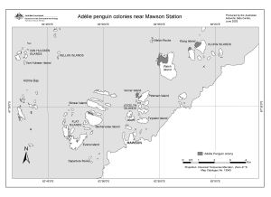
|
Adelie penguin subcolonies, Bechervaise Island View Map Details
Map ID - 13042
Published On - June-2003 Scale - 1 : 2000 Physical Size- 11.7 x 15.3 cm 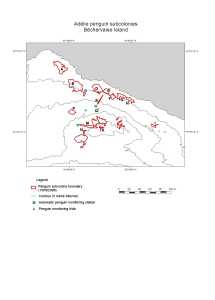
|
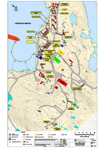
Annex B: Mawson Station Spill Risk Assessment Map
|
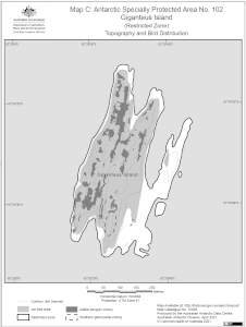
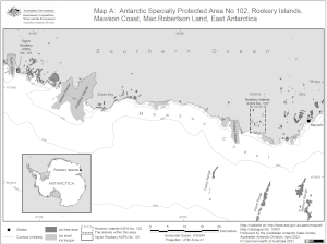
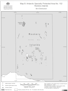
Antarctic Specially Protected Area No. 102
|
Antarctic Specially Protected Area No. 102
|
Antarctic Specially Protected Area No. 102
|
Aus 600 Australian Antarctic Territory - Approaches to Mawson View Map Details
Map ID - 14601
Published On - 18-November-2016 Scale - 1 : 25 000 Physical Size- 119 x 72 cm Vertical Unit - Meters 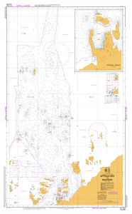
|
Bechervaise Island [Penguin Colonies : Topographical map] View Map Details
Map ID - 12727
Published On - July-2000 Scale - 1 : 6500 Physical Size- 42 x 72 cm ![Bechervaise Island [Penguin Colonies : Topographical map]](/database/mapcat/holme/Bechervaise_Is_topo_2000_12727_thumb.jpg)
|
Bechervaise Island Penguin Colonies : Orthophoto map View Map Details
Map ID - 12724
Published On - July-2000 Scale - 1 : 5000 Physical Size- 42 x 72 cm 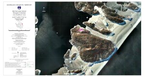
|
Bechervaise Island topographical map View Map Details
Map ID - 12721
Published On - July-2000 Scale - 1 : 10 000 Physical Size- - 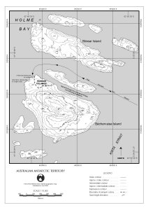
|
Framnes Mountains / Mac.Robertson Land View Map Details
Map ID - 63
Published On - June-1991 Scale - 1 : 100 000 Physical Size- 95.5 x 88.5 cm Vertical Unit - Meters 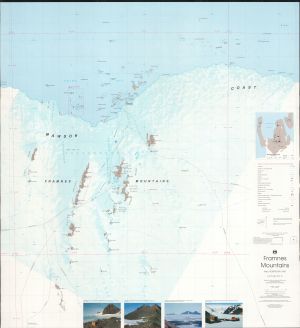
|
Framnes Mountains (Mac.Robertson Land) View Map Details
Map ID - 15760
Published On - October-2022 Scale - 1 : 50 000 Physical Size- 118.9 x 84.1 cm A0 Vertical Unit - Feet 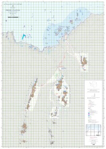
|
Framnes Mountains : Map 1 of 4 View Map Details
Map ID - 15761
Published On - October-2022 Scale - 1 : 50 000 Physical Size- 29.7 x 42 cm A3 Vertical Unit - Meters 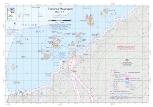
|
Framnes Mountains : Map 2 of 4 View Map Details
Map ID - 15762
Published On - October-2022 Scale - 1 : 50 000 Physical Size- 29.7 x 42 cm A3 Vertical Unit - Meters 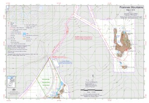
|
Framnes Mountains : Map 3 of 4 View Map Details
Map ID - 15763
Published On - October-2022 Scale - 1 : 50 000 Physical Size- 29.7 x 42 cm A3 Vertical Unit - Meters 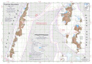
|
Framnes Mountains : Map 4 of 4 View Map Details
Map ID - 15764
Published On - October-2022 Scale - 1 : 50 000 Physical Size- 29.7 x 42 cm A3 Vertical Unit - Meters 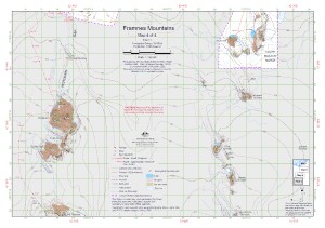
|
Framnes Mountains, Mac.Robertson Land View Map Details
Map ID - 2
Published On - June-1997 Scale - 1 : 100 000 Physical Size- 98 x 69 cm 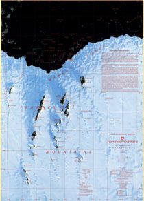
|
Framnes Mountains, MacRobertson Land, Antarctica. Sheet 3 View Map Details
Map ID - 13193
Published On - October-2005 Scale - 1 : 50 000 Physical Size- 64.5 x 106 cm 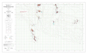
|
Holme Bay [Black and white] View Map Details
Map ID - 13139
Published On - May-2005 Scale - 1 : 261 300 Physical Size- 6 x 10 cm ![Holme Bay [Black and white]](/database/mapcat/holme/holme_bay_bw_thumb.jpg)
|
Holme Bay with Antarctic inset [Black and white] View Map Details
Map ID - 13155
Published On - June-2005 Scale - 1 : 261 300 Physical Size- 6 x 10 cm ![Holme Bay with Antarctic inset [Black and white]](/database/mapcat/holme/holme_bay_bw_with_ant_inset_thumb.jpg)
|
Showing 1 to 20 of 41 maps. On page 1 of 3, go to the Next Page