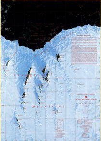
Map 2: Framnes Mountains, Mac.Robertson Land
Map details
| Map Number | 2 |
| Title | Framnes Mountains, Mac.Robertson Land |
| Edition | 2 |
| Previous edition | [Previous edition : 1] |
| Scale | 1 : 100 000 |
| Publication date | June 1997 |
| Publisher |
Australian Antarctic Division (Australia)
|
| Spatial coverage |
( 62.1339° -67.4012°)
,
( 63.6678° -67.4012°)
,
( 63.6678° -68.2171°)
( 62.1339° -68.2171°) |
| Projection | Transverse Mercator |
| Physical size | 98 x 69 cm |
| Notes | Error in Imagery Index. Spot images should be swapped. |
| Reference | Cat.No:L29 in 'ANARE Catalogue of Maps and Hydrographic Charts 1997' |
| Keywords | Mac. , Mac , Robertson , Land , Mawson , Coast , Bechervaise , Stinear , Kista , Strait , Holme , Bay , Forbes , Robinson , Group , Station , North , Masson , Range , Central , South , David , Brown , Horseshoe , Harbour , Satellite Imagery |
Downloads
This is a hard copy map that has been scanned. See information about obtaining copies of hard copy maps.
Map Lists
This map belongs to the following lists. Use the link on the list to see all maps belonging to that list
- ANARE Catalogue of Maps and Hydrographic Charts 1997
- Framne Mountains / Holme Bay / Mawson - extended list
- Satellite image maps
Additional Information
| Horizontal datum | WGS84 |
| Vertical datum | MSL Mawson |
| Nomenclature | Australian Antarctic Gazetteer |
Preview