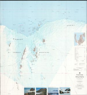
Map 63: Framnes Mountains / Mac.Robertson Land
Map details
| Map Number | 63 |
| Title | Framnes Mountains / Mac.Robertson Land |
| Edition | 1 (Out of Date) |
| Previous edition | [Previous edition : 1] |
| Next Edition | [Next Edition : 2] |
| Scale | 1 : 100 000 |
| Publication date | June 1991 |
| Publisher |
Australian Antarctic Division (Australia)
|
| Spatial coverage |
( 62.0010° -67.3333°)
,
( 64.1030° -67.3333°)
,
( 64.1030° -68.1967°)
( 62.0010° -68.1967°) |
| Projection | Universal Transverse Mercator |
| Physical size | 95.5 x 88.5 cm |
| Notes |
This map was published as a double sided map with a satellite image map one side and a topographic map the other. Downloads of both are available.
The map was also published as just the satellite image map. See Map No. 64. |
| Reference | Cat.No:L12 in 'ANARE Catalogue of Maps and Hydrographic Charts 1997' |
| Keywords | Framnes , Mountains , Mac. , Mac , Robertson , Land , Mawson , Coast , Bechervaise , Stinear , Kista , Strait , Holme , Bay , Forbes , Casey , Ranges , Robinson , Group , Station , North , Masson , Range , Central , South , David , Brown , Horseshoe , Harbour , Satellite Imagery |
Downloads
This is a hard copy map that has been scanned. See information about obtaining copies of hard copy maps.
- A print file (PDF)
- 'A zipped image (TIF) of the topographic map for use in Oziexplorer'
- A LZW compressed TIFF
- Georeferenced TIFF
Map Lists
This map belongs to the following lists. Use the link on the list to see all maps belonging to that list
- ANARE Catalogue of Maps and Hydrographic Charts 1997
- Framne Mountains / Holme Bay / Mawson - extended list
- Oziexplorer maps
Additional Information
| Horizontal datum | WGS84 |
| Vertical unit | Metres |
| Magnetic variation | 64 degrees west in 1990 |
Preview