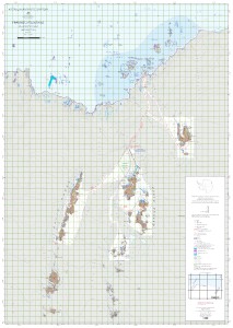
Map 15760: Framnes Mountains (Mac.Robertson Land)
Map details
| Map Number | 15760 |
| Title | Framnes Mountains (Mac.Robertson Land) |
| Edition | 1 |
| Scale | 1 : 50 000 |
| Publication date | October 2022 |
| Publisher |
Australian Antarctic Division (Australia)
|
| Spatial coverage |
( 62.3300° -67.5000°)
,
( 63.1700° -67.5000°)
,
( 63.1700° -68.0000°)
( 62.3300° -68.0000°) |
| Projection | WGS 1984 UTM Zone 41S |
| Physical size | 118.9 x 84.1 cm A0 |
| Keywords | Mac. , Mac , Robertson , Land , Mawson , Coast , Bechervaise , Stinear , Kista , Strait , Holme , Bay , Forbes , Casey , Ranges , Robinson , Group , Station , North , Masson , Range , Central , South , David , Brown , Horseshoe , Harbour , Satellite Imagery |
Downloads
This is a hard copy map that has been scanned. See information about obtaining copies of hard copy maps.
Map Lists
This map belongs to the following lists. Use the link on the list to see all maps belonging to that list
- Framne Mountains / Holme Bay / Mawson - extended list
- Oziexplorer maps
- Framne Mountains / Holme Bay / Mawson - core list
Additional Information
| Horizontal datum | WGS84 |
| Vertical datum | MSL Mawson |
| Vertical unit | Feet |
| Nomenclature | Australian Antarctic Gazetteer |
Preview