Map 12888: Casey Station : Orthophoto map
Map details
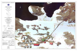
| Map Number | 12888 |
| Title | Casey Station : Orthophoto map |
| Edition | 1 |
| Scale | 1 : 1125 |
| Publication date | August 2002 |
| Publisher |
Australian Antarctic Division (Australia)
|
| Spatial coverage |
(110.5200° -66.2772°)
,
(110.5389° -66.2772°)
,
(110.5389° -66.2803°)
(110.5200° -66.2803°) |
| Projection | Transverse Mercator |
| Physical size | 62 x 96 cm |
| Notes | Orthophoto is compiled from aerial photography flown on December 30, 2000 with a Wild RC8 camera (format 180mm X 180mm) |
| Keywords | Casey Station , Windmill Islands , Newcomb Bay , Vincennes Bay , Orthophoto , Survey Marks , Satellite Imagery |
Downloads
This is a digital map available for downloading.
Map Lists
This map belongs to the following lists. Use the link on the list to see all maps belonging to that list
Additional Information
| Horizontal datum | WGS84 |
| Vertical datum | Mean Sea Level |
| Magnetic variation | Magnetic north is 98 degrees 40' west of true north |
Preview