Windmill Islands / Casey - extended list
View All Map ListsAn extended list of maps of the Windmill Islands including maps of Casey.
Showing 1 to 20 of 40 maps. On page 1 of 3, go to the Next Page
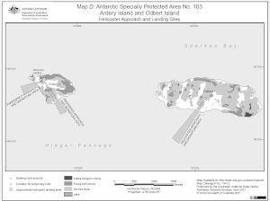
Antarctic Specially Protected Area No. 103
|
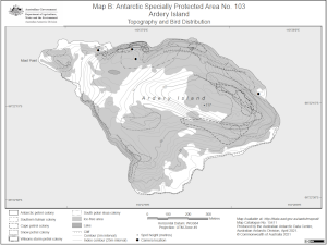
Antarctic Specially Protected Area No. 103
|
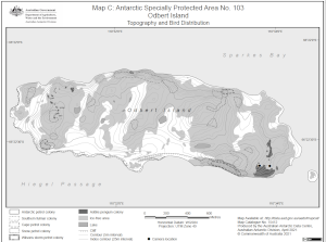
Antarctic Specially Protected Area No. 103
|
Antarctic Specially Protected Area No. 103
|
Antarctic Specially Protected Area No. 136, Clark Peninsula
|
Aus 601 Australian Antarctic Territory - Wilkes Land - Approaches to Casey View Map Details
Map ID - 14505
Published On - 6-November-2015 Scale - 1 : 50 000 Physical Size- 73 x 112 cm 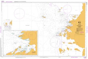
|
Casey Asbestos Presence in Buildings View Map Details
Map ID - 15863
Published On - March-2023 Scale - 1 : 2500 Physical Size- 21 x 29.7 cm A4 Vertical Unit - Meters 
|
Casey Station : Orthophoto map View Map Details
Map ID - 12888
Published On - August-2002 Scale - 1 : 1125 Physical Size- 62 x 96 cm 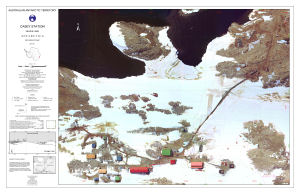
|
Casey Station Area : Orthophoto map View Map Details
Map ID - 12889
Published On - August-2002 Scale - 1 : 3000 Physical Size- 54 x 69.5 cm 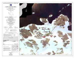
|
Casey Station Heritage View Map Details
Map ID - 15997
Published On - 1-March-2024 Scale - 1 : 15 500 Physical Size- 21 x 29.7 cm A4 Vertical Unit - Meters 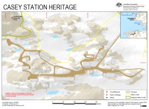
|
Casey to Wilkins Aerodrome View Map Details
Map ID - 16003
Published On - September-2023 Scale - 1 : 200 000 Physical Size- 29.7 x 42 cm A3 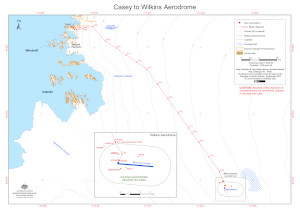
|
Casey to Wilkins Aerodrome
|
Casey: Buildings and Structures View Map Details
Map ID - 15821
Published On - October-2022 Scale - 1 : 2500 Physical Size- 21 x 29.7 cm A4 Vertical Unit - Meters 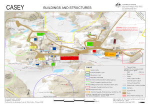
|
Casey: Critical safety map for non-English speaking visitors View Map Details
Map ID - 14479
Published On - 24-November-2015 Scale - 1 : c2200 Physical Size- 21 x 29.7 cm A4 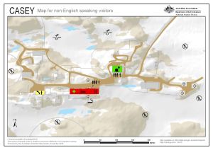
|
Casey: Fire Hydrants View Map Details
Map ID - 16046
Published On - November-2023 Scale - 1 : 2500 Physical Size- 21 x 29.7 cm A4 Vertical Unit - Meters 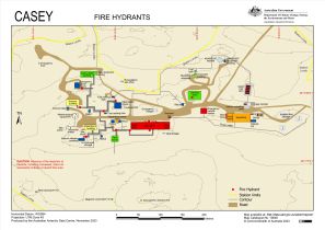
|
Casey: High Voltage Distribution View Map Details
Map ID - 15798
Published On - September-2022 Scale - 1 : 2500 Physical Size- 21 x 29.7 cm A4 Vertical Unit - Meters 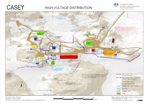
|
Casey: Recreation Limits View Map Details
Map ID - 16005
Published On - September-2023 Scale - 1 : 15 500 Physical Size- 21 x 29.7 cm A4 Vertical Unit - Meters 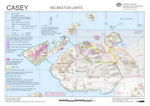
|
Casey: Station Limits View Map Details
Map ID - 16006
Published On - September-2023 Scale - 1 : 8600 Physical Size- 21 x 29.7 cm A4 Vertical Unit - Meters 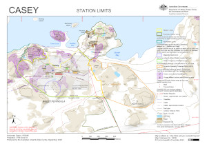
|
Casey: Station Search Zones Map 1 View Map Details
Map ID - 14647
Published On - June-2018 Scale - 1 : 2250 Physical Size- 21 x 29.7 cm A4 Vertical Unit - Meters 
|
Casey: Station Search Zones Map 2 View Map Details
Map ID - 14648
Published On - June-2018 Scale - 1 : 6400 Physical Size- 21 x 29.7 cm A4 Vertical Unit - Meters 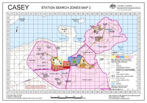
|


Showing 1 to 20 of 40 maps. On page 1 of 3, go to the Next Page