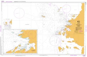
Map 14505: Aus 601 Australian Antarctic Territory - Wilkes Land - Approaches to Casey
Map details
| Map Number | 14505 |
| Title | Aus 601 Australian Antarctic Territory - Wilkes Land - Approaches to Casey |
| Edition | 4 |
| Scale | 1 : 50 000 |
| Publication date | 06 November 2015 |
| Publisher |
Hydrographic Service, Department of the Navy, Wollongong (Australia)
|
| Spatial coverage |
(109.6000° -66.1500°)
,
(110.7500° -66.1500°)
,
(110.7500° -66.4433°)
(109.6000° -66.4433°) |
| Projection | Transverse Mercator |
| Physical size | 73 x 112 cm |
| Notes | The chart includes an inset of Newcomb Bay at 1:12 500. |
| Reference | Aus 601, INT 9021 |
| Keywords | Vincennes Bay , Newcomb Bay , Aus601 , Int 9021 , Chart , Nautical |
Downloads
Map Lists
This map belongs to the following lists. Use the link on the list to see all maps belonging to that list
Additional Information
| Horizontal datum | WGS84 |
Preview