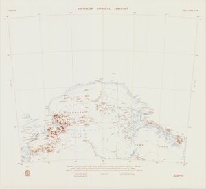
Map 129: SQ 39-40
Map details
| Map Number | 129 |
| Title | SQ 39-40 |
| Edition | Base compilation (Out of Date) |
| Next Edition | [Next Edition : 1] |
| Scale | 1 : 1 000 000 |
| Publication date | August 1969 |
| Publisher |
Department of National Development, Division of National Mapping (Australia)
|
| Spatial coverage |
( 48.0000° -64.0000°)
,
( 60.0000° -64.0000°)
,
( 60.0000° -68.0000°)
( 48.0000° -68.0000°) |
| Projection | Lambert Conformal Conic |
| Physical size | 58 x 63.2 cm |
| Notes | Base Compilation Map |
| Reference | SQ 39-40 |
| Keywords | Napier Mountains , Southern Ocean , Enderby Land , Kemp Land , Sakellari Peninsula , Amundsen Bay , Tula Mountains , Raggatt Mountains , Scott Mountains , King Edward Plateau , Edward Vii Gulf , Law Promontory , King Edward Ice Shelf , SQ39-40 , SQ39/40 , Survey Marks , Topographic |
Downloads
Map Lists
No maps lists available.
Additional Information
Preview