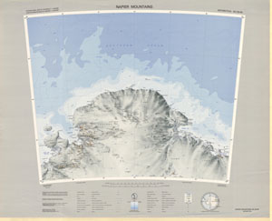
Map 130: SQ 39-40
Map details
| Map Number | 130 |
| Title | SQ 39-40 |
| Edition | 1 (Out of Date) |
| Previous edition | [Previous edition : Base compilation] |
| Next Edition | [Next Edition : 3] |
| Scale | 1 : 1 000 000 |
| Publication date | 1974 |
| Publisher |
Department of National Development, Division of National Mapping (Australia)
|
| Spatial coverage |
( 48.0000° -64.0000°)
,
( 60.0000° -64.0000°)
,
( 60.0000° -68.0000°)
( 48.0000° -68.0000°) |
| Projection | Lambert Conformal Conic |
| Physical size | 58 x 73.5 cm |
| Reference |
SQ 39-40 Cat.No:S1 in 'ANARE Catalogue of Maps and Hydrographic Charts 1997' |
| Keywords | Napier Mountains , Enderby Land , Kemp Land , Sakellari Peninsula , Amundsen Bay , Tula Mountains , Raggatt Mountains , Scott Mountains , King Edward Plateau , Edward Vii Gulf , Law Promontory , King Edward Ice Shelf , SQ39-40 , Survey Marks , Topographic |
Downloads
This is a hard copy map that has been scanned. See information about obtaining copies of hard copy maps.
Map Lists
No maps lists available.
Additional Information
| Nomenclature | Australian Antarctic Gazetteer |
Preview